Author: Prof. Dr. Wolfram Mauser, Vista GmbH
The Agricultural Business Risks in Sub-Saharan Africa
In most sub-Saharan countries food supply is assured by the hard work of a large number of smallholders supplemented by a very small number of large, mechanised farms. Whereas large farmers are commercially successful, the smallholders – due to a general lack of knowledge and mechanisation – only achieve low yields on their small plots (less than 1 ha). Non-existing financial reserves force smallholders to call upon loans for almost all operation of their business, be it for buying seeds, fertilizer, or equipment and harvest storage. The interest rates for these essential loans are usually derived from bagged risk of failure assessment based on a large number of smallholders. Consequently, interest rates are exorbitant, with an average of 36% p.a. Such interest rates have the potential to kill any development of a legal, profitable business under any circumstance. Bringing down interest rates for agricultural loans to single, successful smallholders is therefore of highest priority to ensure their development. Making objective, individual information on status and prospect of their fields available to the financial institutions in charge is at the core of the issue.
Leveraging Satellite-Based Monitoring to Improve Agricultural Risk Assessment
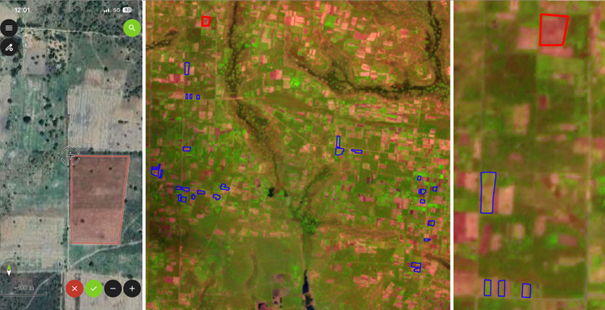
Remote sensing can contribute to this task, and Vista GmbH (Munich, Germany) is analysing how in close collaboration with local partners. Sentinel, EnMAP, and PRISMA data are being used to create an objective fact base of the agricultural operations of selected smallholders, which can then serve as a basis for risk-adapted interest rates. The pilot region of the ARIES de-risking study is Zambia. There, our local partner, a Zambian entrepreneur, has organised approximately 2000 smallholders, who supply him with pig feed (maize, soybean, sorghum), which they produce with climate-smart and regenerative practices. Within the ARIES project, hundreds of plots are digitised and information on crop type and crop status is gathered in the field using tablets by the Zambian partner. The information collected on the ground is then combined with the data flows of satellite sensors and the data sets analysed regarding the development of the crops, possible pests, and yield expectations at the end of the season.
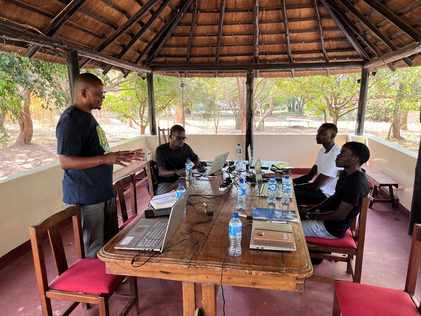
Training of Bwando-Farm team for the digital field survey
Advancing Sustainable Agricultural Finance Through Data‑Driven Insights
The ARIES project will provide valuable information on the potential and limits of currently available remote sensing data to support de-risking of smallholder farming operations in sub-Saharan Africa. It will be used to develop business models, together with the relevant financial institutions, which allow a substantial reduction of ag-loans’ interest rates for the benefit of their commercial success and development.